NSW Story Assisting Compliance Investigations
NSW Satellite Imagery Hub Story
SATELLITE IMAGERY FOR INVESTIGATING ALLEGED UNLAWFUL LAND CLEARING
The role of Planet Imagery to assist Investigations
Objectives
Spatial information services support investigations by the NSW Department of Climate Change, Energy, the Environment and Water of alleged unlawful land clearing.
Outcomes
These services are used to map areas related to an incident or investigation and to assess change in landscapes over time. This includes defining the historic extent of woody vegetation and the retention and removal of vegetation to the present day.
These assessments support investigators to choose the most appropriate approach for each case.
Before and After

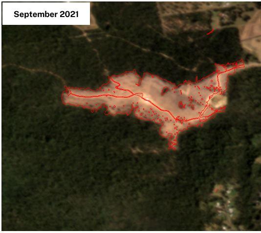
Time series of PlanetScope Monthly images to identify woody vegetation clearing and potential land use change. PlanetScope imagery acquired from near-daily satellite availability and has a resolution of 3.7m. For more information email [email protected]