NSW Story Maitland Floods
NSW Satellite Imagery Hub Story

The role of Planet imagery in delineating flood extent at Maitland NSW during July 2022
Objectives
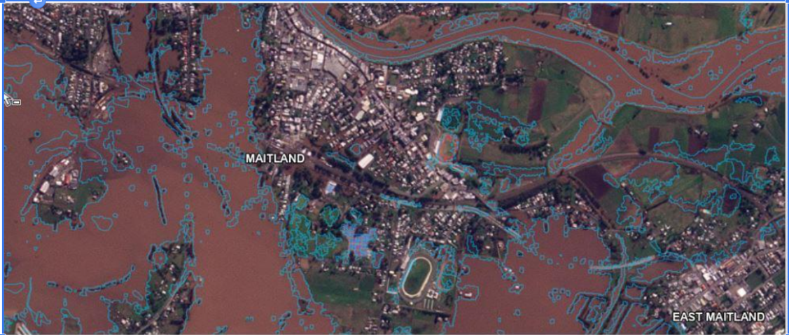
In July 2022, Maitland Local Government Area experienced a major flood event (10.41m). Riverine flooding closed 55 roads including the New England Highway and isolated several populated areas for days.
Planetscope imagery from the NSW Satellite Imagery Hub was used in conjunction with freely available Copernicus EMSR586 data (blue lines) to determine maximum flood extents.
Outcomes
Benefits of timely satellite imagery
The imagery was used to identify flood affected land and relate this to flood management planning.
Supporting local councils
Maitland Council continues to use Planet satellite imagery of flood events for the assessment of damage occurring to Council buildings and assets, as well as for the planning of evacuation centres and evacuation routes.

“Planet imagery confirmed the extent of the flood digitized by EMR586 and provided the first LGA- wide data for flooding in Maitland” – Ben Nicholson, GIS Lead, Maitland City Council
PlanetScope imagery acquired from near-daily satellite availability and has a resolution of 3.7m. For more information, contact [email protected].
