NSW Story Bushfire management
NSW Satellite Imagery Hub Story
The role of Planet Imagery in assisting with bushfire management
Objectives
As our climate continues to warm, bushfires pose an extremely serious risk to local NSW communities.
Data captured from near-daily Planet satellite imagery supports the creation of operational mapping products and burn severity maps, enabling fire management teams to review ecological and risk objectives.
Satellite imagery provides analysts with higher confidence in predictive models for bushfire management, understanding which areas will provide a reduction in fire spread and intensity, and how species will respond to the fire impacts.
Outcomes
Post-fire decision support
Planet satellite imagery adds to an array of other data sources providing comprehensive information during phases of bushfire management, including post-fire recovery and restoration.
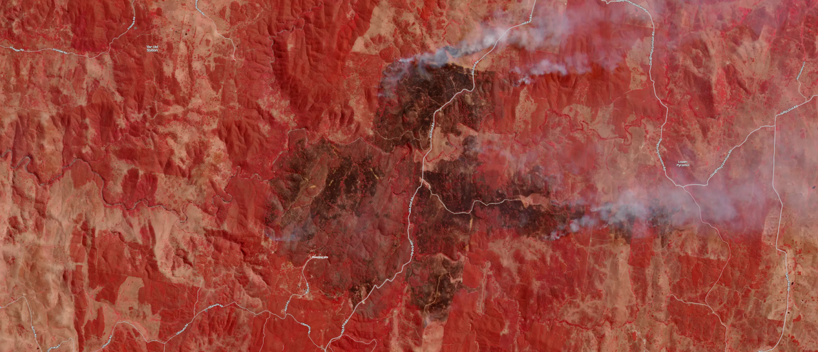
Smoke and air quality monitoring
Monitoring from space provides a bird’s eye view of smoke and air quality during events.
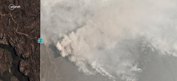
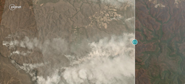
PlanetScope imagery acquired from near-daily satellite availability and has a resolution of 3.7m. For more information, contact [email protected].