NSW Story Lachlan Valley
NSW Satellite Imagery Hub Story
The role of Planet Imagery in monitoring drought conditions in Lachlan Valley
Objectives
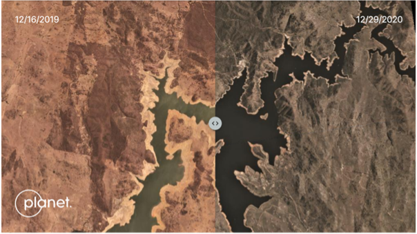
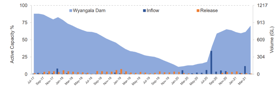
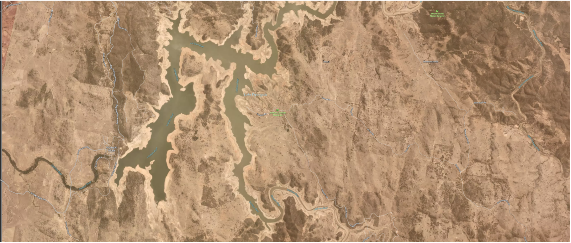
From 2017 to 2020, NSW experienced a record-breaking drought that affected the whole state. Between January 2017 and December 2019, NSW temperatures were the warmest and rainfall was the lowest on record. The Lachlan Valley was declared to be in Stage 3 – Severe Drought with Wyangala Dam at 26% by July 2019. The drought was the worst in terms of storage inflows over the historical record from the 1890’s.
Outcomes
Timely communication
The NSW Government is committed to earlier communication with communities when conditions indicate that we may be approaching drought. Clear and early communication will allow landholders and water users to better prepare for potential restrictions and ensure that applications for groundwater approvals and drought infrastructure are in place early.
Long term drought monitoring
Satellite imagery is a useful tool for information on drought conditions and contributes to frameworks measuring risk for community preparedness.
Before and After